Generated with Monsha
Dominican Republic Map Labelling Worksheet
Worksheet · Grade 12 · English
Dominican Republic Map Labelling Worksheet
Instructions
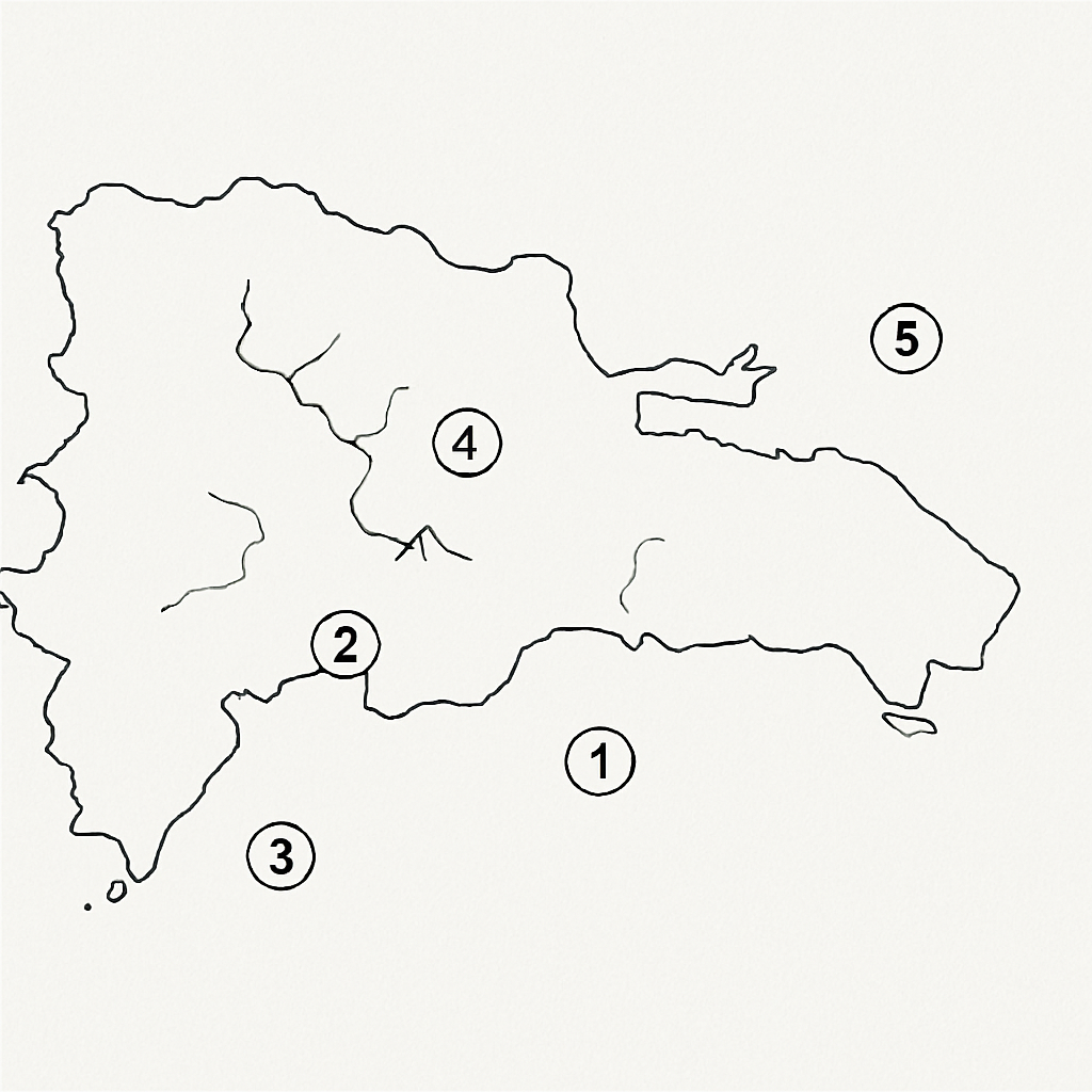
Label the following key features on the map of the Dominican Republic. Use the word bank provided. Write the correct name next to each number on the diagram.
Word Bank:
- Santo Domingo
- Pico Duarte
- Lake Enriquillo
- Yaque del Norte River
- Samaná Peninsula
Diagram Labelling Activity
[Image: A blank map of the Dominican Republic with 5 numbered locations for students to label]
- Capital city located on the southern coast, near the Ozama River.
- The highest mountain peak in the Caribbean, located in the Cordillera Central.
- The largest lake in the Caribbean, found in the southwest, below sea level.
- The longest river in the country, flowing northwest through the Cibao Valley.
- A prominent peninsula extending into the Atlantic Ocean in the northeast.