Generated with Monsha
Locating Places on the Earth - Lesson Plan
Lesson Plan · 6 · English
Locating Places on the Earth - Lesson Plan
Lesson Overview
Subject: Social Science (Geography)
Grade: 6 (CBSE/NCERT New Syllabus 2024)
Chapter: 1 — Locating Places on the Earth
Duration: 40 Minutes
1. Objectives & Learning Outcomes
By the end of this lesson, students will be able to:
- Define the concepts of latitudes and longitudes as imaginary lines on the globe.
- Identify important parallels of latitude (Equator, Tropics, Circles) and the Prime Meridian.
- Explain the importance of the geographic grid system in locating any point on Earth.
- Understand how time varies with longitude and the concept of Indian Standard Time (IST).
2. Standards Addressed
- NCERT/CBSE Learning Outcomes: Understanding the Earth as a sphere and the use of the globe as its model; identifying coordinates to pinpoint locations.
- National Curriculum Framework (NCF): Promoting spatial thinking and the ability to interpret maps and globes.
3. Material & Resources Needed
- A physical Globe or a 3D digital model.
- NCERT Class 6 Textbook: Exploring Society: India and the World.
- World Map (Physical and Political).
- Smartboard/Projector for visual aids.
- Student Worksheet (Concept Map included below).
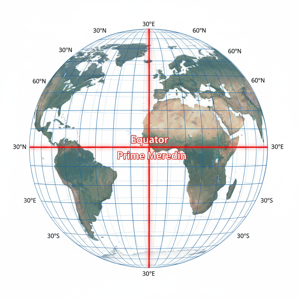
4. Key Concepts
- The Globe: A true model (miniature form) of the Earth.
- Latitudes: Horizontal imaginary lines running parallel to the Equator. Key lines include:
- Equator
- Tropic of Cancer
- Tropic of Capricorn
- Longitudes: Vertical imaginary lines running from the North Pole to the South Pole.
- Prime Meridian
- Grid System: The network of latitudes and longitudes that helps in locating places accurately.
5. Assessment and Evaluation Plan
- Formative Assessment (During Lesson): Quick "Point and Name" activity using the globe where students identify the Equator and Prime Meridian.
- Summative Assessment (Post Lesson): Completion of the "Locating Places Concept Map" worksheet.
- Exit Ticket: Ask students to write down the coordinates of their own city (approximate) using a map.
6. 21st Century Skills / College & Career Readiness Skills
- Critical Thinking: Analyzing why a coordinate system is necessary for global navigation and aviation.
- Information Literacy: Interpreting spatial data from a globe or map.
- Communication: Explaining complex geographical concepts using correct terminology.
7. Instructional Sequence (40 Minutes Total)
Time | Activity | Description |
|---|---|---|
0-5 mins | Introduction & Hook | Ask: "If you are in the middle of the ocean, how do you tell a rescue team exactly where you are?" Introduce the Globe as our model. |
5-15 mins | Understanding Latitudes | Use the globe to show the Equator dividing Earth into Northern and Southern Hemispheres. Explain the system. |
15-25 mins | Understanding Longitudes | Explain the Prime Meridian and the Eastern/Western Hemispheres. Discuss the meridian. |
25-35 mins | Activity: The Grid | Distribute the Concept Map worksheet. Students work in pairs to relate Latitudes, Longitudes, and the Grid system. |
35-40 mins | Recap & Conclusion | Summarize the main parallels and meridians. Preview the next lesson on Indian Standard Time. |
8. Differentiation Strategy
- For Visual Learners: Use the interactive 3D globe and color-coded diagrams of the heat zones.
- For Kinesthetic Learners: Have students use a ball and thread to "draw" latitudes and longitudes around the sphere.
- For Advanced Learners: Challenge them to calculate the time difference between two cities based on their longitudes (e.g., London and New Delhi).
Student Worksheet
Name:
Date:
LOCATING PLACES ON EARTH CONCEPT MAPGrade 6: Concept Map & Relationships
Instructions:Write 'Locating Places' in the top box. In the three boxes below, identify the key components (Latitudes, Longitudes, and the Grid System) and explain their purpose in finding a location on the globe.
MAIN TOPIC
IS DETERMINED BY
LATITUDES
LONGITUDES
GRID SYSTEM
Summary of Connections: